Key Takeaways
active_faultsis the fault source in Stratigraphic Amenity, a geology AI tool from Eigenform: an open-source MCP server for scanned geologic maps (maps that show which rocks lie where). It lists active faults, cracks in the Earth’s crust that can still move, inside a map’s area, using a worldwide fault database (GEM Global Active Faults) and, for Italy, a more detailed Italian one (DISS).- Use it to see which known faults cross or touch an area where a company is looking for minerals, so a geology AI assistant can point to real records instead of guessing. Without it, someone would download a fault database, open it in mapping software and check the area by hand.
- It reads a saved copy of the GEM database on the computer by default; the Italian source is only used when you ask for it.
- In some parts of the world, such as Canada, the worldwide database has little detail, so the tool warns you there. No result is never proof that no active fault exists.
TL;DR
Give this geology AI tool an area, and it lists the known active faults that run through it: their name, how they move, how long they are and how steeply they slope into the ground. It warns you when the worldwide database has little detail there, and when nothing turns up it says so plainly instead of calling the area safe.
What Is the active_faults Provider?
active_faults is one of the knowledge providers in Stratigraphic Amenity. It returns fault features that intersect a bounding box, either one you pass directly or the stored area of a registered map. It is enabled by default, so a geology AI agent gets it whenever it looks up earthquakes, faults and minerals for an area.
How Does Geology AI Find Active Faults?
Two sources are configured: gem_global_active_faults first and diss_seismogenic_sources second. A query uses only GEM unless provider_options.active_faults names a source or sources.
GEM: the global source
The GEM Global Active Faults Database is published under CC BY-SA 4.0. The server reads it from a synced mirror when one exists, or from the copy in the installed geological knowledge base, with the warning “active_faults: using legacy local asset because no source mirror was found.” GEM has no live mode.
The operator builds a mirror with python -m stratigraphic_amenity.knowledge.sources.sync gem_global_active_faults, which writes the data and a provenance manifest under the knowledge sources folder.
DISS: Italy on request
DISS 3.3.1 is a regional database of seismogenic sources for Italy and surrounding areas. The server queries its public WFS service live, and only when a request selects it. Its coverage box runs from 5° to 20° east and 35° to 48.5° north. Outside it, the result warns that the source “does not cover the requested bounds” and skips it.
Lines or boxes: the geometry engine
GEOMAP_KNOWLEDGE_FAULT_GEOMETRY_ENGINE decides how a fault is matched to the area:
| Setting | Behaviour |
|---|---|
auto (default) | Uses Shapely when installed, otherwise boxes |
shapely | True line-against-box intersection, with a spatial index |
bbox | Compares each fault’s bounding box with the area |
With bbox, a long diagonal fault can match an area it never actually crosses. Shapely comes with the server’s knowledge-local extra.
What comes back
Each record keeps slip_type, name, catalog_name, length_in_kilometers, dip_dir, average_dip, average_rake, lower_seis_depth and upper_seis_depth, plus a geometry_bbox. Records are sorted by name and limited to 50 by default. When GEM and DISS both run, a feature that appears twice is merged on the first identifier it has: id, fid, source_id or name.
Coverage Gaps in the Active Fault Database
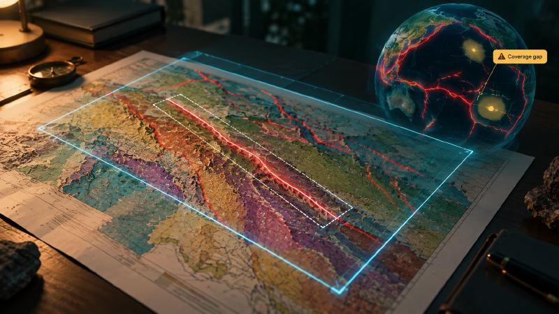
GEM documents coarse coverage near Canada, Madagascar and the Malay Archipelago. When an area touches one of these, the result adds: “GEM active-fault coverage has a documented coarse gap near” the region, noting that missing features “may reflect source coverage rather than absence of active faults.”
When nothing intersects at all, the summary reads: “No active fault features intersected the bounds; this is not evidence that no active faults exist.”
FAQs
Which regions does the active fault data cover?
GEM covers active faults in most tectonically active regions worldwide, with documented coarse gaps near Canada, Madagascar and the Malay Archipelago. DISS adds detail for Italy and surrounding areas when a request selects it. A warning appears whenever the area touches a known gap or lies outside DISS coverage.
Why does a fault appear that does not cross my area?
Either the bounding-box engine is in use, or the fault’s line really does cross a corner. With bbox, faults are matched by their bounding box, so a long diagonal fault can match an area it never touches. Installing Shapely, or setting the engine to shapely, matches the actual line.
Can I use the Italian DISS database instead of GEM?
Yes. Set source to diss_seismogenic_sources in provider_options.active_faults, or list both sources to combine them. DISS is queried live, so the request goes online, and it only returns faults inside its coverage box around Italy. Elsewhere the result warns that the source does not cover the area.
How are faults drawn on the map?
The knowledge overlay draws each fault as its geometry_bbox, the smallest rectangle around it, rather than as a line. A long fault therefore covers more of the picture than the fault itself, so read the records before judging how close a fault passes to a target.
Try It With Geocluster
Stratigraphic Amenity is one of the Geocluster tools, MCP servers that let AI agents work with geology data and maps.
Faults are half of the hazard picture; the other half is the earthquake history of the region.