Key Takeaways
earthquake_historyis the earthquake source in Stratigraphic Amenity, Eigenform’s open-source MCP server for scanned geologic maps (maps that show which rocks lie where), the program an AI assistant uses to work with them. It finds past earthquakes recorded inside a map’s area, using public lists of recorded earthquakes from the USGS (the United States Geological Survey) and EMSC (the European-Mediterranean Seismological Centre).- Use it to check how often the ground shakes around an area where a company is looking for minerals, or to give a geologic AI assistant real records instead of guesses. Without it, someone would search an earthquake website by hand, copy the coordinates and match them to the map.
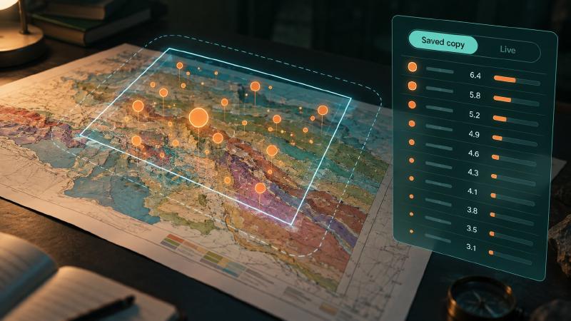
- By default it reads a saved copy of the USGS catalogue on the computer, so nothing goes online unless you ask for live data.
- No result does not mean no earthquakes: it only means none matched the chosen catalogue and filters.
TL;DR
Give this geologic AI tool an area, and it lists the earthquakes recorded there: when, where, how strong and how deep. It reads a saved copy of the USGS catalogue unless you ask for a live check, and you can narrow the list by date and size.
What Is the earthquake_history Provider?
earthquake_history is one of the knowledge providers in Stratigraphic Amenity. It returns recorded earthquakes inside a bounding box, either one you pass directly or the stored area of a registered map. It is enabled by default, so a geologic AI agent gets it whenever it looks up earthquakes, faults and minerals for an area.
How Does Geologic AI Look Up Earthquake History?
Two sources are configured, usgs_fdsn_events first and emsc_fdsn_events second. A query uses only the first unless provider_options names others.
Where the records come from
The USGS source runs in one of three modes, recorded as source_mode:
| Mode | What it reads | When it is used |
|---|---|---|
local_mirror | A synced, normalised copy of the USGS catalogue with its own manifest | When a mirror exists |
legacy_asset | The USGS file inside the installed knowledge base | When no mirror exists, with a warning |
live | The USGS earthquake catalogue service, queried on the spot | Only when you ask for it |
Without a mirror, the result says: “earthquake_history: using legacy local asset because no source mirror was found.” That file comes with the geological knowledge base, so installing it is enough for offline lookups.
A mirror is built by the operator with python -m stratigraphic_amenity.knowledge.sources.sync usgs_fdsn_events, optionally limited to a box with all four of --min-lon, --min-lat, --max-lon and --max-lat. The EMSC source is live: the server asks the EMSC service each time it is selected.
Filtering by date and size
provider_options.earthquake_history accepts:
source,sourcesorsource: "all"to choose catalogues;source_modeto forcelocal_mirror,legacy_assetorlive;starttimeandendtime, written as timestamps such as2025-01-01;minmagnitudeandmaxmagnitude;reviewstatus,catalogandcontributor, passed to the catalogue.
In the local modes the search reaches 0.05 degrees, about 5.5 km, beyond the box, so quakes just outside the map edge are included.
What comes back
Results are sorted newest first, then by magnitude, and limited to 50 records by default. Each record keeps the catalogue’s time, latitude, longitude, place, mag, magType, depth, type, updated and gap. The summary reads “Found N earthquakes within bounds; returning M records.”
The provenance names every source used, its mode, licence and citation, and the margin. When two catalogues report the same event, duplicates are removed only where their event IDs overlap exactly; there is no fuzzy matching on time or place. If one of several sources fails, the others still answer and the failure becomes a warning.
What to Watch For
- A live query sends the area and filters to a third party. Catalogues also change, so a live answer today may differ from tomorrow’s.
- An empty result describes the chosen catalogue and filters, not the ground.
- The saved knowledge-base copy is a snapshot: recent earthquakes appear only in a fresh mirror or a live query.
FAQs
Where does the earthquake data come from?
From the USGS earthquake catalogue, read from a synced mirror, from the copy in the installed knowledge base, or live from the USGS service. EMSC, the European-Mediterranean Seismological Centre, is a second, live-only source an agent can add. Each result’s provenance names the source, its mode, licence and citation.
How do I get only large or recent earthquakes?
Pass minmagnitude or starttime in provider_options.earthquake_history, for example a minimum magnitude of 4.5 and a start date of 2025-01-01. The same filters work in every mode. In live mode they are sent to the USGS service; in local modes the server applies them to the saved copy.
Does the lookup send data to the USGS?
Only in live mode. By default the server reads a saved copy of the catalogue and makes no network request. A live query sends the bounding box and filters to the USGS or EMSC service, which reveals the area being studied, so the server never goes live unless the request asks for it.
Why are some earthquakes just outside my map?
In the local modes, the search deliberately reaches 0.05 degrees, about 5.5 km, past the edges of the box, so events near the boundary are not missed. When the results are drawn on the map, those points fall outside it and are flagged, which is expected rather than a sign of misplaced coordinates.
Try It With Geocluster
Stratigraphic Amenity is one of the Geocluster tools, MCP servers that let AI agents work with geology data and maps.
Earthquakes are half of the hazard picture; the other half is the active faults near a location.