Key Takeaways
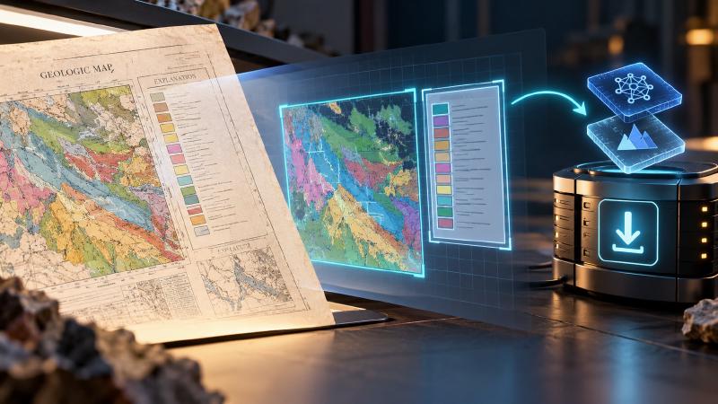
geomap_prepare_detectorsis the install tool for map detection in Stratigraphic Amenity, Eigenform’s open-source MCP server for scanned geologic maps (the program an AI assistant uses to work with them). It downloads the map-detection model, a geology machine learning model (a program that learned from many example maps), which the server does not come with.- With the model installed, the assistant can take a scanned map sheet apart: it finds the map itself, the colour key (the legend), the title and the scale bar, and cuts each one out. It also cuts out the map’s corners, where the grid numbers that place the map on Earth are printed. Without it, someone would have to crop and measure the scan by hand before the assistant could use it.
- The assistant should ask you first, because the download is about 200 MB and is saved on the computer where the map server runs. It should then use the map server’s own install tool, not download the files itself, or they can land in the wrong place, like a file saved into a folder the program never looks in.
- Installing the model is not always enough. The map server may also need extra software that only the person running it can add, and the tool says so when that is the case.
TL;DR
Before an AI assistant can find the colour key and the map on a scanned map, the map server needs a model of about 200 MB. The server has its own install tool, which downloads only the right files and checks that nobody has changed them. The assistant should ask you first, then use that tool, and never download the files itself.
What Is geomap_prepare_detectors?
geomap_prepare_detectors is the install tool for map detection in Stratigraphic Amenity, Eigenform’s open-source (MIT) MCP server for scanned geologic maps. An MCP client is the app where the AI assistant runs; the server gives it geology tools. This tool downloads the geology machine learning model behind map detection and puts it where the server expects it.
That model is what lets the server find the legend and map parts on a scan. The tool takes no inputs and installs exactly two entries from the server’s approved list, assets/manifest.toml:
| Asset | What it is | Source and licence |
|---|---|---|
peace-yolov10-runtime | PEACE’s adapted YOLOv10 code | Pinned commit of Microsoft’s PEACE repository, AGPL-3.0 |
peace-layout-detectors | Trained detector weights | PEACE’s published archive, MIT, SHA-256 checked |
Both go into the standard folders under the server’s data root. The tool is exposed by default, and an operator can hide it with GEOMAP_MCP_ENABLE_DETECTOR_PREPARATION=false.
When Does an Agent Need the Geology Machine Learning Model?
An agent should first check what the map server can do. If map_processing.ready is false, its missing_requirements list says what is absent, and the usual remedy is this tool. Until map processing is ready, the agent should not call geomap_process_image.
Why Not Install From the Agent’s Own Shell?
Many agents can run commands, so downloading the weights with curl or running the installer directly looks quicker. The project’s agent guide forbids it, for three reasons.
The shell is a different environment
The agent’s shell and the MCP server are separate programs, often on separate machines or in separate containers. Files the agent writes land in its own environment, not in the server’s data root. The server then still reports the model as missing, and the agent may hunt for a cause that is not there.
The tool cannot be steered
The tool accepts no URL, folder, asset ID or force flag, so a model cannot be talked into fetching anything else. Custom model or runtime folders are rejected with detector_configuration_mismatch.
The install is checked
The installer checks each download against a recorded SHA-256 or tree hash. It rejects archives that try to write outside their folder, contain symlinks or unpack beyond a set size. It also unpacks into a staging folder and swaps it in at once, so a failed run never leaves a half-installed model. A quick shell download skips all of that.
Why Ask the User First?
The tool description says it plainly: it “performs network access and writes to disk; confirm with the user before calling.” The download is about 200 MiB, and unpacking briefly needs substantially more disk space. The runtime is also AGPL-3.0 code, a different licence from the server’s own MIT code. So a geology machine learning workflow should say what will be downloaded and why, then wait for a yes.
Once is enough. The tool is idempotent: when both assets are already complete, it reports already-installed and downloads nothing.
What Comes Back
On success, the summary reads “Prepared 2 approved detector assets. Map processing is ready.” The result also carries performs_network_access: true and a fresh map_processing report.
The weights are only part of the setup. The detector also needs Python packages from the server’s detectors extra, and this tool cannot install packages. If they are missing, the summary says map processing “is still not ready; this tool installs assets only and cannot install Python packages.” The agent then passes the remaining requirements to the server operator, or carries on with georeferencing and knowledge lookups, which need no detector.
FAQs
Does geomap_prepare_detectors need any inputs?
No. It takes an empty input and always installs the same two approved assets, the PEACE YOLOv10 runtime and the layout detector weights, into the server’s standard data folders. Callers cannot pass a download URL, a folder, an asset ID or a force flag, so nobody can redirect the download.
Why is the tool missing from my MCP client?
The server operator has switched it off with GEOMAP_MCP_ENABLE_DETECTOR_PREPARATION. Only a blank value or a clear “true” keeps it, so a typo also hides it. The capability report then says preparation is disabled. Ask the operator to install the assets or re-expose the tool; never install from the client’s shell.
What happens if the install fails?
The download unpacks in a staging folder, so a failed run does not leave a broken install in place. The call returns asset_install_failed with a trace ID. If an asset folder exists but is incomplete, the tool will not overwrite it; the operator checks the server log and force-reinstalls that asset.
Does the server need a restart afterwards?
Not for the assets. The result includes a fresh readiness report, so if it says map processing is ready, the agent can call geomap_process_image straight away. Missing Python packages are different: the operator installs them in the server environment and restarts the server, which this tool cannot do.
Try It With Geocluster
Stratigraphic Amenity is one of the Geocluster tools, MCP servers that let AI agents work with geology data and maps.
Rock-type, earthquake and fault lookups need a separate download, covered in installing the geological knowledge base.