TL;DR
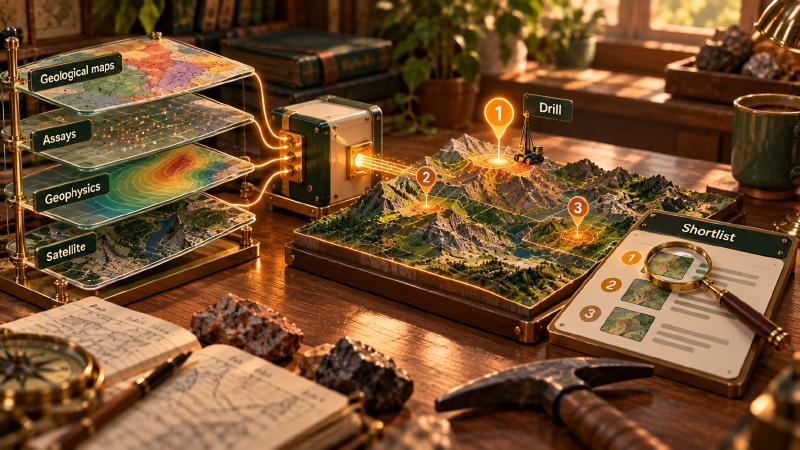
- AI in mineral exploration mainly means using machine learning models to rank and prioritize drill targets from geological, geochemical and geophysical data faster than manual interpretation allows.
- It doesn’t replace the geologist’s judgment; it changes what gets reviewed first, and the model is only as reliable as the data sources and validation behind it.
Key Takeaways
- AI-powered exploration changes prioritization speed, not the underlying geology. Models rank targets faster; they don’t discover deposits that aren’t in the data.
- Traditional and AI-powered methods differ mainly in scale and consistency. A geologist’s interpretation doesn’t scale across large datasets the way a trained model does, but a model also can’t apply judgment the way a geologist can.
- Data quality determines model quality more than model choice does. Geological maps, geochemical assays and geophysical surveys need consistent processing before a model can use them reliably.
- Model selection depends on data type and target geology, not a single best model. A model built for porphyry-style targeting won’t transfer cleanly to a different deposit type without re-validation.
- The main challenges are data scarcity, labeling and validation, not model architecture. Confirmed discoveries are rare relative to the data volume, which limits how models can be trained and tested.
AI in mineral exploration comes down to one decision: where to look next, and in what order. A team may hold decades of maps, drillhole assays, geophysical surveys and reports, more than one geologist can read closely. Machine learning, however, can rank ground across all of it at once.
At Eigenform we build prospectivity models and turn scanned geological maps into data an AI agent can query. We also test which AI models can be trusted with exploration reports.
Comparing Traditional and AI-Powered Mineral Exploration Methods
Artificial intelligence in mineral exploration uses machine learning to rank areas by how likely they are to host a deposit. It combines geological, geochemical, geophysical and remote sensing data, then flags anomalies and scores each target. Drilling still tests every target it produces.
Traditional targeting is expert-driven. A geologist first pictures the mineral system: where the metal came from, how it moved and what trapped it. Then they read each dataset against that picture. The method works with a handful of known deposits and explains itself. However, it scales slowly, and two geologists can rank the same data differently.
AI exploration targeting is data-driven. A model learns the signature of known deposits across many layers, or flags unusual combinations. Then it scores every cell in a region by one rule. Because it only sees its inputs, it cannot find a deposit that leaves no trace in them, nor tell geology from an artifact of how the data was collected.
| Traditional, expert-driven | AI-powered, data-driven | |
|---|---|---|
| Scale | One area, a few layers at a time | Whole regions, dozens of layers |
| Few known deposits | Works through geological reasoning | Struggles unless built for it |
| Typical failure | Misses patterns spread across large datasets | Finds patterns that are not geology |
Where AI exploration targeting still needs a geologist
The two methods work best together. Our prospectivity pipeline runs hundreds or thousands of regressions over a regional dataset. However, a relationship stays only if it makes the whole geological picture easier to explain. This coherence mapping drops a strong correlation that contradicts everything else, just as a geologist would.
The output is a belief map: a 3D grid of what may lie underground, where brighter cells mean stronger evidence. Each relationship stays or goes by how much it improves the model as a whole.
Report-reading AI needs the same kind of check. Our partners at NextMaps tested their pipeline on a gold exploration license with 56 open-file reports. Many of those reports also discuss neighboring leases holding about a million ounces of gold. A naive system for AI in mining exploration would credit the license with its neighbors’ gold.
Their error-correcting harness is built to prevent it. It tags each drillhole and named place with its distance from the license boundary before the model writes anything.
Key Data Sources for Machine Learning Mineral Exploration
Every machine learning mineral exploration project starts by bringing four kinds of data, often decades old, onto a common grid. Scanned maps and reports must first become numbers or text. Conversion and labeling errors then act as they do in ground truth data for AI: they pass into every result. That is why data quality decides model quality more than the choice of model does: every model inherits the same misread coordinate or mistyped assay.
Geological maps and lithological data
Geological maps record rock types (lithology), contacts, faults and ages. Many exist only as scans. A scan stays just pixels until someone matches the legend to the map colors and ties the sheet to real coordinates.
We built Stratigraphic Amenity for that step. It is an open-source Python toolkit plus an MCP server, which lets AI agents call its tools. The toolkit finds the map, legend and cross-sections on a sheet and georeferences it from ground control points. Then it queries ten knowledge providers for faults, earthquakes and, where a regional database exists, mineral occurrences.
In one georeferencing example, a corner coordinate misread by 300 meters spread an even 75-meter error across four control points. No single point looked wrong, but a leave-one-out check exposed it. Once a sheet is located, geological map vectorization turns its polygons into GIS layers a model can use.
Geochemical assay data
Assays are laboratory measurements of element concentrations in soil, rock or drill samples. They are the most direct evidence of mineralization, and the most convention-bound. For example, labs write a result below their detection limit as “<0.005”. Some countries use a comma as the decimal point, and one rock type gets typed three ways.
Geophysical survey data (magnetic, gravity, radiometric)
Geophysical surveys measure physical properties of the ground, usually from aircraft. Magnetic surveys map magnetite-bearing rocks and the faults and intrusions that cut them. Gravity surveys map density contrasts. Radiometric surveys measure potassium, thorium and uranium at the surface, which can reveal alteration.
These grids are the backbone of most prospectivity models because, unlike drilling, they cover whole regions evenly. In a copper skarn, a magnetic anomaly, an intrusive contact and copper in drill core can share one history. So a model should not treat them as three independent clues.
Remote sensing and satellite imagery
Satellite imagery maps what is exposed at the surface. Multispectral sensors such as Sentinel-2 and Landsat separate broad rock and vegetation types. Imaging spectrometers go further: they pick out alteration minerals, such as clays and iron oxides, around many hydrothermal deposits.
For example, NASA’s EMIT imaging spectrometer maps surface minerals from the International Space Station at about 60-meter pixels. Germany’s EnMAP satellite works at about 30 meters. The limit is cover, because soil, vegetation and deep weathering hide the rock below.
How Do You Select the Right AI Model for Mineral Exploration?
No single model is best. Instead, the right choice depends on four questions.
Matching a geological data AI model to the target
| Question | What it points to |
|---|---|
| What deposit type is the target? | Inputs and a model chosen for that mineral system |
| How many known deposits are there? | Few: knowledge-driven or unsupervised methods. Many: classifiers such as random forests |
| Must geologists see why an area scores high? | Interpretable models, or an explanation per target |
| How will it be validated? | A validation plan written before training |
A model built for porphyry copper will not transfer cleanly to orogenic gold. The two systems leave different footprints in the same data. Interpretability matters too. In our coherence approach, each relationship is a stated link, such as gold with bismuth. A geologist can therefore see which link lifted a target, and reject it.
Validation decides the rest. Hold out known deposits from a different area, not random cells beside the training data. Neighboring cells share geology, so a random split makes a model look better than it is.
Testing language models on exploration reports
The same logic applies to large language models that read reports. Choosing one is a problem of AI model evaluation. That means one task, one reference, one scoring rule and a known margin of error.
We built Groundtruth, Eigenform’s open-source benchmark for geological reasoning, to run that test. Models answer questions from real exploration reports in three 50-question sets: Technical, WAMEX and USGS. A separate judge model then scores each answer against a rubric built from the source report. On 50 questions, the smallest gap we can detect between two models is 0.27 to 0.45 points out of 10.
In our runs, the top four models were statistically tied. So the answer to which AI model is best for your geology is a tier first, then a price.
Challenges of Using AI in Mineral Exploration
The main limits of AI in mineral exploration have little to do with model architecture. Instead, they come from scarce examples, uncertain labels, messy records and the cost of checking a prediction.
Data scarcity and class imbalance
A study area can hold hundreds of thousands of grid cells and only a few dozen known deposits. With that class imbalance, a model can look accurate by predicting “no deposit” almost everywhere. The known deposits, the only positive labels a model gets, are also a biased sample: mostly the ones that cropped out or were easy to reach.
Positive-unlabeled learning, one of the macrotrends in AI exploration we track, treats unexplored ground as unlabeled rather than barren. Our coherence approach works from the other side. When few deposits are confirmed, the way independent observations fit one geological history is the strongest evidence a model has.
Inconsistent historical data quality
We scored 190 historical USGS reports for text quality. In one 1920s report, scanning errors made 18% of the pages unreliable. Detection limits and lab methods also changed, so assays from different decades are not always comparable.
Location is a problem too. On one project, boreholes existed only as hand-drawn symbols on Soviet-era maps, with no digital coordinates. Recovering that borehole data meant vectorizing the sheets first. Then we recovered their transformation from the old Pulkovo system to modern coordinates.
Validation difficulty
The only full test of a prospectivity model is drilling, and one new hole can cost around $500,000. Discoveries also take years to confirm. As a result, many models can only be checked against known deposits, sometimes ones they were trained on.
Cheaper checks still catch errors. Our Geocluster Research Harness requires every number in an answer to cite the file and column it came from. In Meridian Ridge, a synthetic project that ships with the harness, that rule exposes a report quoting about 70 basalt samples when the data holds 62.
Overfitting to one deposit style or region
A model trained in one terrain learns its quirks: survey coverage, weathering, sampling history. Elsewhere, those quirks become false signals. Therefore a new region or deposit style needs validation on local data.
We have measured a similar effect in language models that read reports. Across our three Groundtruth document sets, the top tier held. However, the lower half of the eight-model ranking changed order from one set to the next. A prospectivity model tested in a single region could hide a shift like that.
FAQs
What is AI in mineral exploration?
AI in mineral exploration is the use of machine learning to decide where to explore. Models rank ground by how likely it is to host a deposit. They also spot anomalies in survey and assay data and read old reports. Geologists review the shortlist; drilling decides.
How does AI-powered exploration differ from traditional methods?
Traditional targeting relies on a geologist reading each dataset against a model of the mineral system. It works with few known deposits, but it scales slowly and varies between people. AI-powered exploration, by contrast, applies one learned rule to every cell in a region. It is fast and consistent, but it needs clean data and expert review.
What data is used to train AI models for mineral exploration?
Prospectivity models usually train on gridded layers. They include map lithology and structure, assay chemistry, magnetic, gravity and radiometric surveys, and satellite imagery of alteration minerals. Known deposits serve as the positive examples. Report-reading language models come pretrained; teams adapt and test them on their own documents, as with most LLM use cases.
How do you choose the right AI model for mineral exploration?
Start from the target deposit type and the data you have. With few known deposits, prefer knowledge-driven or unsupervised methods. With many, supervised classifiers become an option. Pick a model whose rankings geologists can inspect. Plan validation before training: hold out known deposits from another area and check that the model still ranks them highly.
What are the main challenges of using AI in mineral exploration?
Confirmed deposits are rare compared with the ground explored, so models have few positive examples. Those examples are also biased toward easy finds. Historical data is inconsistent, with scanning errors, changing detection limits and old coordinate systems. Finally, validation is slow and expensive, and models trained on one region often transfer poorly.