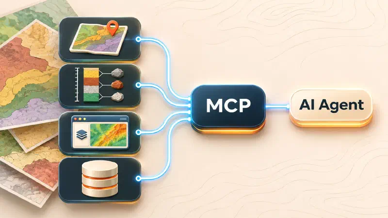
TL;DR: An MCP server is a small program that lets an AI assistant use extra tools, such as reading drillhole tables, working with a geological map or running a GIS operation. The best choice depends on your data: Geocluster MCP for exploration datasets, Stratigraphic Amenity for scanned geological maps, QGIS MCP for desktop GIS projects and PostGIS MCP for spatial databases. Running a server on your own computer does not keep your data private, because the AI model may still send prompts and tool results to an outside provider.
The best MCP server for geoscience depends on what you need an AI agent to do. Some repositories expose GIS operations, others connect to spatial databases or provide tools for geological maps and exploration datasets. This guide compares the most relevant GitHub projects by capabilities, maintenance, use cases and setup requirements.
Which MCP Servers Support Geoscience and GIS Workflows?
1. Geocluster MCP (Eigenform): Exploration Data Processing and Analysis
What It Does
Geocluster MCP is a Python-based MCP server for exploration-geoscience data. Its default catalogue contains 45 tools for working with tabular datasets and raster files.
Key Features
- Supports CSV, Excel and LAS well-log inputs.
- Supports GeoTIFF raster data.
- Inspects datasets, columns, missing values and raster properties.
- Profiles drillhole geochemistry.
- Cleans, transforms and joins datasets.
- Supports raster reprojection, resampling, clipping and grid alignment.
- Performs feature engineering and clustering.
- Supports anomaly detection and ranking.
- Creates maps, plots and other visualisations.
- Includes provenance summaries, artifact exports and claim verification.
Maintenance and Licence
The repository has 46 commits and an Apache-2.0 licence. Its current README documents 45 tools and Python 3.12 support. Check the GitHub activity before publication for the latest commit and release information.
Best Use Cases
- Drillhole and assay data analysis.
- Geochemical profiling and anomaly ranking.
- Raster inspection and spatial processing.
- AI-assisted exploration-data workflows.
Setup Notes
- Requires Python 3.12 and
uv. - Supports SSE, Streamable HTTP and STDIO.
- File access is restricted to a configured workspace.
- Derived outputs are stored in workspace or conversation-specific results folders.
- The
verify_claimstool compares reported numbers against source data.
Geocluster MCP is a good fit when an AI agent needs to perform operations on exploration data, rather than simply discuss it.
2. Stratigraphic Amenity (Eigenform): Geological Map Operations
What It Does
Stratigraphic Amenity is a Python 3.11 SDK and local MCP server for geological map operations. It supports map registration, affine georeferencing, geological knowledge retrieval and evidence rendering.
Key Features
- Registers geological map images.
- Supports map-body and legend processing.
- Uses ground control points for georeferencing.
- Retrieves geological knowledge for mapped areas.
- Supports information retrieval for faults, rock types, rock ages and mineral occurrences.
- Renders retrieved evidence onto maps.
- Returns warnings, record counts and provenance with results.
Maintenance and Licence
The repository has 30 commits and an MIT licence. Its README identifies version 0.1.0. It is an early-stage project, so check its release history and compatibility before using it in a production workflow.
Best Use Cases
- Geological map registration.
- Affine georeferencing.
- Geological knowledge retrieval.
- Building evidence-backed map workflows.
Setup Notes
- Requires Python 3.11.
- Runs locally through STDIO.
- Uses
GEOMAP_MCP_ALLOWED_ROOTSto restrict which map directories the server can access. - The full installation profile includes detector assets and additional dependencies.
- It is not an OCR or vision-language model. The client supplies OCR, visual interpretation and answer generation.
For setup guidance, see Eigenform’s guide to geological knowledge base setup guide.
Stratigraphic Amenity is best understood as a map-operations and evidence layer within a larger geological map-understanding workflow.
3. QGIS MCP: AI Access to QGIS
What It Does
QGIS MCP connects an MCP-compatible AI agent to the QGIS desktop application. It uses a QGIS plugin and a separate MCP server to expose QGIS operations.
Key Features
- Provides 125 MCP tools.
- Manages GIS projects and layers.
- Adds, edits and exports features.
- Runs QGIS processing algorithms.
- Supports map rendering, styling and layouts.
- Provides cross-layer SQL operations.
- Includes plugin development and system-management tools.
- Works with clients such as Claude Code, Codex CLI, Gemini CLI, Cursor, VS Code and others.
Maintenance and Licence
The repository’s releases page lists v0.15.3, released on 11 November 2026. The README documents compatibility with QGIS 3.28–4.x. It uses the GPL-2.0 licence.
Best Use Cases
- Automating existing QGIS projects.
- Managing layers and features through AI agents.
- Running geoprocessing algorithms.
- Creating and rendering GIS maps.
- Teams already using QGIS as their desktop GIS application.
Setup Notes
- Requires QGIS 3.28 or later and
uv. - The QGIS plugin must be installed and running.
- The MCP server runs outside QGIS and communicates with the plugin.
- The default transport is STDIO.
- Destructive operations and access to arbitrary PyQGIS execution require careful permission settings.
QGIS MCP is a strong option when an agent needs to work directly with an existing desktop GIS environment. It is a general GIS integration, not a geology-specific analysis engine.
4. PostGIS MCP: Spatial Database Access
What It Does
PostGIS MCP is a TypeScript-based MCP server that connects AI clients to PostgreSQL databases with the PostGIS extension.
Key Features
- Provides an MCP connection to PostGIS databases.
- Supports multiple database connection variables.
- Includes development and production configuration.
- Supports hot reloading.
- Allows custom table and domain aliases through
domain-aliases.json. - Uses PostgreSQL and PostGIS for spatial data storage and operations.
Maintenance and Licence
The repository currently shows two commits and no visible release history. Its README documents the implementation and setup, but there is limited evidence of ongoing maintenance. Treat it as a project to test rather than an established production default.
Best Use Cases
- Connecting AI agents to existing PostGIS databases.
- Accessing spatial data stored in PostgreSQL.
- Workflows where a spatial database is the main source of geospatial information.
Setup Notes
- Requires Node.js 14 or higher.
- Requires PostgreSQL with the PostGIS extension.
- Uses npm or yarn for dependency management.
- Uses the ISC licence.
- Database credentials are configured through environment variables.
- Review exposed operations and database permissions before connecting it to production data.
PostGIS MCP is narrower than QGIS MCP. Its main purpose is database connectivity, not desktop GIS automation.
5. Geospatial MCP Servers: Repository Discovery Directory
What It Does
This is a curated directory of MCP servers for geospatial, GIS, mapping and earth-observation workflows. It is a discovery resource, not an MCP server itself.
Key Features
- Tracks repositories across geocoding, routing and mapping.
- Includes spatial database and analytics projects.
- Covers STAC and remote-sensing integrations.
- Lists QGIS and ArcGIS-related connectors.
- Records implementation language and deployment type.
- Distinguishes official projects from community projects.
- Tracks whether listed services are open-source, commercial or hosted.
Maintenance and Licence
The repository has 139 commits and an MIT licence. Its catalogue is generated from a structured server registry. It also maintains health information for listed projects. Check the current catalogue before selecting a connector.
Best Use Cases
- Discovering additional GIS MCP servers.
- Finding STAC and satellite-imagery connectors.
- Comparing local and hosted geospatial integrations.
- Checking project activity before evaluating a server.
Setup Notes
- Not every listed entry is open-source.
- Some entries are hosted commercial services.
- Some projects are community-maintained.
- Check each project’s licence, setup instructions and actual capabilities.
Use this directory to discover candidates. Evaluate each project separately before adopting it.
MCP Servers for Geoscience and GIS Compared
| Server | GIS or geology use case | Language | Deployment | Transport |
|---|---|---|---|---|
| Geocluster MCP | Exploration data and spatial analysis | Python | Local | SSE, Streamable HTTP, STDIO |
| Stratigraphic Amenity | Geological map operations | Python | Local | STDIO |
| QGIS MCP | QGIS project automation | Python | Local plugin and server | STDIO by default |
| PostGIS MCP | Spatial database access | TypeScript | Local | STDIO |
| Geospatial MCP Servers | MCP server discovery | Multiple | Varies | Varies |
The table describes the documented deployment models. The Geospatial MCP Servers project is a directory, so its language, deployment and transport depend on the individual entry.
Best MCP Servers for Geological Data and Exploration Workflows
Geocluster MCP for Drillhole, Geochemistry and Raster Workflows
Choose Geocluster MCP when the workflow involves:
- Drillhole and assay tables.
- Geochemical profiling.
- Data cleaning and validation.
- Anomaly detection and clustering.
- Raster inspection and processing.
For example, an agent can inspect an assay dataset, identify missing values, profile selected elements, transform the data and run supported clustering operations.
It can then save derived outputs and use provenance tools to review how they were generated.
The workspace restriction is important. File paths must remain inside the configured workspace. This creates a defined boundary for file operations.
Other Exploration and Geoscience Data Connectors
A general GIS connector may support spatial operations without understanding exploration-specific concepts.
For example, a server that can buffer geometries or query a spatial database is not automatically capable of interpreting assay intervals or ranking geochemical anomalies.
When evaluating another geoscience MCP server, check whether it supports:
- Drillhole and assay data.
- Geochemical profiling.
- Spatial joins and coordinate transformations.
- Raster inspection and processing.
- Geological or geophysical data formats.
- Provenance and validation of derived results.
Choose based on the documented operations, not just the word “geospatial” in the repository description.
Best MCP Servers for GIS, Mapping and Earth Observation
Stratigraphic Amenity for Geological Map Registration and Knowledge Retrieval
Choose Stratigraphic Amenity when the workflow involves:
- Scanned geological maps.
- Map-body and legend registration.
- Ground control points.
- Affine georeferencing.
- Geological knowledge retrieval.
- Evidence rendering.
A complete map-understanding workflow may use a vision model to identify text or symbols. Stratigraphic Amenity can then support georeferencing and geological evidence operations.
It complements OCR and vision models rather than replacing them.
QGIS MCP for Desktop GIS Automation
QGIS MCP is a good fit when the agent needs to operate on an existing QGIS project.
Its tools cover:
- Layer management.
- Feature editing.
- Processing algorithms.
- Map styling and rendering.
- Project and layout operations.
- Spatial analysis.
The architecture requires the QGIS application and plugin to be available. It is not simply a remote spatial database connector.
PostGIS and Spatial Database MCP Servers
PostGIS MCP is useful when spatial data is already stored in a database.
A team may have administrative boundaries, survey locations, geological features or other spatial records in PostGIS. An MCP server can expose database operations to an AI agent, depending on its implementation.
Before connecting an agent to a database, review:
- Which tables and schemas it can access.
- Whether it supports read-only operations.
- Whether write operations are exposed.
- How credentials are stored.
- How queries and large results are handled.
Do not give an agent unrestricted access to a production spatial database simply because an MCP configuration works.
STAC and Remote-Sensing MCP Servers
STAC, or SpatioTemporal Asset Catalog, is a specification for describing and discovering geospatial assets.
A STAC-based MCP connector can help an AI agent search catalogues for satellite imagery and other earth-observation data.
A typical workflow might be:
- Search for imagery by location and time.
- Filter results by collection or metadata.
- Select suitable assets.
- Pass the assets to a geospatial processing tool.
- Analyse the resulting raster or derived data.
The Geospatial MCP Servers directory is a useful starting point for finding these connectors. However, a catalogue entry is not proof that a server is maintained or production-ready. Verify its repository and deployment model independently.
How to Connect an MCP Server to an AI Assistant
Local STDIO, SSE and Streamable HTTP
MCP servers use different transports to communicate with clients.
- STDIO: The client starts the server as a local process and communicates through standard input and output.
- SSE: The server exposes an HTTP endpoint using Server-Sent Events.
- Streamable HTTP: The client communicates with the server through HTTP requests and streaming responses.
These are deployment choices, not quality rankings. Use the transport documented by the server and supported by the MCP client.
Example Configuration for a Geoscience MCP Server
The following examples are adapted from the repositories’ own setup instructions. Replace local paths and credentials with the values from your environment.
1. Geocluster MCP
Install the repository dependencies:
git clone https://github.com/EigenformAI/geocluster-mcp
cd geocluster-mcp
uv sync
Start the server with a defined workspace:
MCP_WORKSPACE_ROOT=/path/to/your/project uv run python main.pyFor an SSE-capable MCP client, use:
{
  "mcpServers": {
    "geocluster": {
      "url": "http://localhost:7654/sse"
    }
  }
}
2. Stratigraphic Amenity
Install the full profile:
git clone https://github.com/EigenformAI/stratigraphic-amenity.git
cd stratigraphic-amenity
uv sync --group dev --extra mcp --extra geo --extra assets --extra detectors
Register the server with an MCP client that reads JSON configuration:
{
  "mcpServers": {
    "stratigraphic-amenity": {
      "command": "uv",
      "args": [
        "--directory", "/ABS/PATH/stratigraphic-amenity",
        "run", "--no-sync", "stratigraphic-amenity-mcp"
      ],
      "env": {
        "GEOMAP_MCP_ALLOWED_ROOTS": "/ABS/PATH/maps"
      }
    }
  }
}
Replace both paths with the actual checkout and map directories. The repository documents STDIO transport.
3. QGIS MCP
Install the QGIS MCP plugin through the QGIS Plugin Manager. Restart QGIS and start the server from its dock widget.
For Codex CLI, the repository documents:
codex mcp add qgis -- uvx --from https://github.com/nkarasiak/qgis-mcp/archive/refs/heads/main.zip qgis-mcp-serverThe plugin must remain active inside QGIS for the connection to work.
4. PostGIS MCP
Clone the repository and install dependencies:
git clone https://github.com/receptopalak/postgis-mcp.git
cd postgis-mcp
npm install
The repository provides this example MCP configuration:
{
  "mcpServers": {
    "postgis": {
      "command": "npx",
      "args": ["tsx", "server.ts"],
      "env": {
        "NODE_ENV": "development",
        "DB_URL_1": "postgres://user:pass@host:5432/db_one",
        "DB_URL_2": "postgres://user:pass@host:5432/db_two"
      }
    }
  }
}
Use actual database connection values. Store credentials securely and do not commit them to source control.
MCP Server Permissions, Workspace Boundaries and Data Privacy
An MCP server gives an AI client access to external tools. That access should be limited.
Before deployment:
- Restrict file access to the required workspace.
- Use read-only database credentials where possible.
- Limit access to required schemas and tables.
- Avoid exposing unrelated project folders.
- Review which tools can modify or delete data.
- Keep database credentials outside source control.
- Validate generated outputs before using them in reports or decisions.
Local execution does not guarantee that all data stays local. The MCP server may run on your machine while the AI model runs through an external provider. Prompts, selected data and tool outputs may still be sent to that provider.
Check the model provider’s data policies and your MCP client’s configuration before connecting sensitive exploration or commercial datasets.
Which MCP Server Should You Choose?
The best MCP server depends on the workflow.
- Choose Geocluster MCP for exploration datasets, geochemical analysis and spatial processing.
- Choose Stratigraphic Amenity for geological map registration, georeferencing and evidence retrieval.
- Choose QGIS MCP for controlling QGIS projects through AI agents.
- Choose PostGIS MCP when you need an MCP connection to a spatial database.
- Use Geospatial MCP Servers to discover additional GIS and earth-observation integrations.
Start with the data and operations your team needs. Then compare deployment, permissions, maintenance and compatibility. A long tool list is useful only when the tools solve the right problem.
FAQs
What are the best open-source MCP servers for geology, geoscience and GIS, and which tools can connect AI agents to geological maps and spatial data?
Geocluster MCP supports exploration-data workflows, Stratigraphic Amenity provides geological map operations, QGIS MCP connects agents to QGIS, and PostGIS MCP connects them to spatial databases.
What is a GIS MCP server?
A GIS MCP server exposes geospatial tools or data to an AI client through the Model Context Protocol. Depending on the project, it can support spatial queries, map operations, data processing or GIS application control.
Can an MCP server connect an AI agent to QGIS?
Yes. QGIS MCP connects an MCP-compatible agent to QGIS through a plugin and server architecture. Its tools cover layer management, feature editing, processing and map rendering.
What is the difference between a GIS MCP server and a geology MCP server?
A GIS MCP server generally exposes spatial operations such as layer management, geometry processing or database queries. A geology MCP server adds tools for geological maps, exploration datasets or specialist geoscience workflows.
Can Geocluster MCP process drillhole and geochemistry data?
Yes. It supports CSV, Excel and LAS inputs. Its tools include geochemical profiling, data cleaning, transformations, spatial operations, clustering and anomaly analysis.
Does Stratigraphic Amenity perform OCR on geological maps?
No. It supports map registration, affine georeferencing, geological knowledge retrieval and evidence rendering. OCR, vision-language interpretation and answer generation are handled by the client.