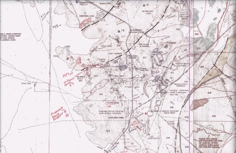
We recently worked with NextMaps on georeferencing maps drawn by Jack Hallberg: his 1:25,000 geological maps of Western Australia’s Yilgarn greenstone belts. The result is that prospectors can now view the sheets directly under their tenements via the NextMaps platform. Georeferencing means matching marks on each scan to real-world coordinates, called ground control points. Many of the sheets are hand-drawn drafts with no printed map frame, where cell corners are only small crosses or dots and coordinates sit on the older AGD66 datum rather than modern GDA2020 / MGA. Even state-of-the-art commercial models struggle to parse these maps out of the box: a full scan is larger than the resolution at which the AI can pin pixel coordinates accurately, and the AI cannot verify projection math, apply the national grid-shift correction that prevents a silent 200-meter datum offset, or test whether a single misread control point has skewed the fit. To solve this, our workflow pairs visual reading by the AI with deterministic geometry and quality gates built on our open-source toolkit.
Georeferencing maps from ground control points with Stratigraphic Amenity
Most of the tools we used for digitizing historical maps live in Stratigraphic Amenity, our open-source Python SDK and local Model Context Protocol (MCP) server for geological map operations:
- Affine georeferencing and leave-one-out QA. Its
georefmodule fits pixel-to-world transforms from ground control points, reprojects bounds, and runs the leave-one-out holdout check that flags a misread coordinate before a sheet is accepted. For the Hallberg sheets we built on that foundation with thin-plate splines for 6+ points, line snapping and grid densification. - Map layout detection. Its
map_processingmodule wraps the layout detector from Microsoft’s PEACE project to locate the map body and margin boxes on a scanned sheet before the AI reads them. - Strict separation between reading and math. Stratigraphic Amenity reads no text on purpose, because the AI can fill in plausible coordinates when results look complete. Keeping coordinate system resolution, projection math and validation in deterministic Python code while leaving only visual reading to the AI is the split that made the Hallberg georeferencing reliable.
Stratigraphic Amenity is one of the Geocluster tools, the open-source MCP servers we publish so the AI can work with geological maps and spatial datasets without improvising the math.
Try the Hallberg layers on NextMaps
Digitizing historical maps and georeferencing maps are only worth it when people use the result. All 353 Hallberg sheets are now georeferenced as part of the new WA map layers on NextMaps, where they appear from zoom level 10 with the paper made transparent so the satellite imagery shows through, and each sheet links back to the DMPE scan it came from.
If you hold ground in the Yilgarn, you can open the interactive NextMaps WA map directly, turn on the Hallberg layers under your tenements, and see what Hallberg drew there.