TL;DR Geospatial AI means using software to work with maps and location data, and “geological map understanding” means getting a model to read the symbols, colours and legends on a geological map. Open source repositories on GitHub cover different jobs: placing a scanned map on real-world coordinates, preparing map and exploration data, answering questions about a map image, and learning the basics. They are not interchangeable, so start by naming the job you need done, then pick the repository that does it.
Geospatial AI covers several different tasks. Some repositories help models interpret map images. Others register scanned maps to real-world coordinates, process raster data or run spatial analysis. Choosing the right geological map processing workflow depends on understanding these differences. This guide compares useful GitHub repositories for geological maps, georeferencing and geospatial AI, including tools that connect spatial operations to AI agents.
Which GitHub Repositories Help With Geospatial AI and Geological Map Understanding?
1. Stratigraphic Amenity (Eigenform): Geologic Map Registration and Evidence Operations
Description
Stratigraphic Amenity is a Python 3.11 SDK and local MCP server for composable geological map operations. It supports map registration, affine georeferencing, geological knowledge retrieval and evidence rendering. It builds on the workflow introduced by Microsoft PEACE (covered below) but is an independent project, not affiliated with or endorsed by Microsoft.
Why it works
- Provides a structured workflow for registering scanned geological maps.
- Detects the map body and legend boxes on a map image, without reading their text.
- Supports ground control point-based affine georeferencing.
- Connects registered map locations with geological knowledge retrieval.
- Renders evidence so map-related results can be inspected.
- Exposes operations through an MCP server for use by compatible AI clients.
Is it up to date?
The public repository showed activity in October 2026 when checked for this article. Its README describes the project as an active Python SDK and local MCP server.
Best for
- Georeferencing scanned geological maps.
- Connecting map operations to an AI agent.
- Retrieving geological context for registered map locations.
- Building workflows where map evidence needs to remain inspectable.
Additional notes
Stratigraphic Amenity is not an OCR or vision-language model. It does not independently read every label or interpret a geological map image. OCR, visual recognition and answer generation are left to the client application.
2. Geocluster MCP (Eigenform): Agent-Accessible Geospatial and Exploration Data Tools
Description
Geocluster MCP is an MCP server with 45 tools that exposes geospatial and exploration-data operations to compatible AI agents.
Why it works
- Supports raster inspection and spatial operations.
- Includes reprojection, resampling, clipping and grid alignment.
- Provides feature operations and data-analysis tools.
- Works with GeoTIFF rasters and tabular inputs such as CSV, Excel and LAS.
- Makes structured data operations available through MCP tools.
Is it up to date?
The public repository showed activity in October 2026. Check its current README and release history before deployment because supported tools and input formats can change.
Best for
- Inspecting geospatial datasets through an AI agent.
- Preparing raster and tabular exploration data.
- Running repeatable spatial operations.
- Connecting geospatial workflows to MCP-compatible clients.
Additional notes
Geocluster MCP is an agent-accessible tool server, not a standalone geological map interpretation model. It provides operations that an agent can call. The quality of the final interpretation still depends on the data, model and workflow.
3. Microsoft PEACE / GeoMap-Agent: Multimodal Geological Map Understanding
Description
Microsoft PEACE is a research project for geological map understanding with multimodal large language models. It includes GeoMap-Agent and GeoMap-Bench, and the benchmark dataset is hosted on Hugging Face rather than in the GitHub repository.
Why it works
- Uses hierarchical information extraction to manage complex map components.
- Adds geological domain knowledge to support map reasoning.
- Uses prompt-enhanced question answering for spatial reasoning.
- Provides a benchmark for evaluating geological map understanding.
GeoMap-Bench contains 124 geological maps and 3,864 multimodal questions across 25 task types. The tasks cover extracting information, grounding, referring, reasoning and analysis.
Is it up to date?
The project records its code and dataset release in January 2025, followed by updates to metrics and its demo in 2025. Treat it as a research release and verify compatibility before building a production workflow around it.
Best for
- Research into multimodal geological map interpretation.
- Evaluating models on geological map questions.
- Understanding how domain knowledge can improve map reasoning.
- Exploring benchmark-driven map AI workflows.
Additional notes
PEACE is a research system and benchmark, not a general GIS package. Its benchmark results should be interpreted within the tasks and dataset used by the project.
4. GeoAI: Python Tools for Geospatial AI
Description
GeoAI is an open-source Python package for geospatial AI workflows. It brings geospatial data processing and machine-learning capabilities into a Python environment.
Why it works
- Provides tools for geospatial data workflows.
- Supports experimentation with geospatial machine learning.
- Connects Python-based geospatial analysis with AI methods.
- Has documentation and examples that help users explore supported workflows.
Is it up to date?
The repository publishes regular releases and was updated in November 2026. Check the current release notes for compatibility with your Python and geospatial dependencies.
Best for
- Learning geospatial AI with Python.
- Experimenting with geospatial deep learning.
- Building workflows around raster and vector data.
- Exploring reproducible notebook-based projects.
Additional notes
GeoAI is a toolkit, not a ready-made geological map interpretation agent. Review the documentation for the specific task you need rather than assuming every geospatial AI workflow is supported.
5. GeoAI Tutorials: Practical Learning Examples
Description
GeoAI Tutorials provides notebook-based examples for learning geospatial AI workflows.
Why it works
- Gives learners practical examples to inspect and adapt.
- Helps connect Python code with geospatial AI concepts.
- Provides a starting point for experimentation before building a larger application.
Is it up to date?
Check the repository’s recent commits and notebook dependencies before using an example. A notebook can remain useful even when its original package versions need updating.
Best for
- Learning through practical examples.
- Exploring geospatial AI workflows.
- Adapting notebook code for small experiments.
Additional notes
Tutorial repositories are learning resources. They should not be compared directly with production GIS libraries or specialist geological map agents.
Geospatial AI GitHub Repositories Compared
| Repository | Main task | Input data | Language | Project type |
|---|---|---|---|---|
| Stratigraphic Amenity | Geological map registration and evidence operations | Scanned maps, control points and geological context | Python | SDK and MCP server |
| Geocluster MCP | Spatial and exploration-data operations | GeoTIFF, CSV, Excel and LAS | Python | MCP server |
| Microsoft PEACE | Multimodal geological map understanding | Geological map images and questions | Python | Research agent and benchmark |
| GeoAI | Geospatial machine learning | Geospatial raster and vector data | Python | Python toolkit |
| GeoAI Tutorials | Learning geospatial AI workflows | Notebook examples and datasets | Python | Tutorial repository |
These projects solve different problems. A map-understanding benchmark measures model performance. A georeferencing SDK registers an image to geographic coordinates. An MCP server exposes operations to an AI agent. A Python toolkit supports geospatial analysis and machine learning.
Best GitHub Repositories for Geological Map Understanding
Microsoft PEACE: GeoMap-Agent and GeoMap-Bench
PEACE is the most directly focused research project in this list for multimodal geological map understanding.
Its benchmark tests several abilities:
- Extracting information from geological maps.
- Grounding answers in map regions.
- Referring to specific map components.
- Reasoning about geological relationships.
- Analysing map content.
This matters because geological maps contain more than labels. They combine symbols, colours, legends, boundaries, annotations and spatial relationships. A model may recognise text but still misunderstand how a geological unit relates to a fault or map region.
GeoMap-Agent provides a research example of combining map processing with geological knowledge and question answering.
Stratigraphic Amenity: Map Registration and Geological Evidence Retrieval
Stratigraphic Amenity complements map-understanding systems by handling map operations.
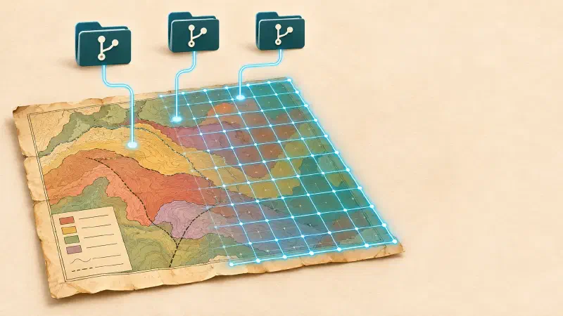
Its workflow includes ground control points, coordinate registration and affine georeferencing. Once a map is registered, geographic context can be connected to its locations.
This is useful when a scanned map needs to be aligned with a coordinate reference system before spatial queries can be performed.
For a practical explanation, see the workflow for georeferencing scanned geological maps.
Map Image Analysis: What to Check Before Choosing a Repository
MapReader and similar map-image analysis projects may be useful for historical or scanned map collections. However, map-image analysis is not automatically geological map interpretation.
Before selecting a repository, check:
- Whether it supports the image format you have.
- Whether it detects text, symbols, regions or map features.
- Whether it provides a reproducible workflow.
- Whether its documentation includes examples relevant to geological maps.
- Whether the code and dependencies are still usable.
Do not assume a general map-image analysis library understands geological legends or stratigraphic relationships.
Best GitHub Repositories for Georeferencing and Spatial Analysis
Stratigraphic Amenity: Geologic Map Georeferencing
Use Stratigraphic Amenity when the primary task is registering a scanned geological map and connecting it to geographic context.
A georeferencing workflow generally needs:
- A scanned map image.
- Ground control points with known geographic coordinates.
- A coordinate reference system.
- A transformation method.
- An error check to assess the fit.
The output is a map aligned to geographic coordinates. That makes it possible to compare the map with other spatial datasets.
Geocluster MCP: Raster and Spatial Operations
Geocluster MCP is useful after spatial data is available in a processable format.
Its documented operations include raster inspection, reprojection, resampling, clipping and grid alignment. These operations help prepare data for analysis and make datasets easier to compare.
For example, raster layers may use different coordinate reference systems or pixel sizes. They need to be aligned before meaningful pixel-level comparison.
GDAL, Rasterio and GeoPandas: Core Geospatial Building Blocks
These established Python and geospatial projects are useful when building custom workflows.
- GDAL: A foundational library and command-line toolkit for raster and vector geospatial data.
- Rasterio: Python tools for reading, writing and working with raster datasets.
- GeoPandas: Python data structures and operations for working with vector geospatial data.
They are not complete geological AI agents. They provide building blocks that developers can combine with machine-learning models, map-processing systems and domain-specific tools.
Best GitHub Repositories for GeoAI Learning and Experimentation
GeoAI
Start with GeoAI if you want to explore geospatial machine learning in Python. Review its documentation and examples to identify tasks that match your data.
GeoAI Tutorials
Use the tutorial repository when you want notebook-based examples. Run a small example, inspect its inputs and outputs, and then adapt it to your own dataset.
A Practical Starting Sequence
A useful learning sequence is:
- Learn raster and vector data basics.
- Load and inspect a small geospatial dataset.
- Practise coordinate reference systems and reprojection.
- Explore a geospatial machine-learning example.
- Add geological context and evaluate the results.
This approach helps separate data preparation from model interpretation. It also makes debugging easier because each stage has a clear output.
Conclusion
The best geospatial AI repository depends on the task. PEACE is a research project for multimodal geological map understanding. Stratigraphic Amenity focuses on geological map registration and evidence operations. Geocluster MCP exposes spatial and exploration-data tools to AI agents. GeoAI and its tutorials support broader Python-based geospatial AI work.
These repositories are complementary rather than interchangeable. Identify whether your problem is map interpretation, georeferencing, spatial processing or machine learning before choosing a tool.
FAQs
What are the best GitHub repositories for geospatial AI and geological map understanding, including map interpretation, georeferencing and AI-powered spatial analysis?
Microsoft PEACE, Stratigraphic Amenity, Geocluster MCP and GeoAI are useful starting points. They cover different tasks, from multimodal map understanding to georeferencing, spatial operations and geospatial machine learning.
What is the best open-source AI tool for understanding geological maps?
Microsoft PEACE / GeoMap-Agent is a research project specifically designed for geological map understanding. It includes GeoMap-Bench for evaluating multimodal models on geological map tasks.
What is the difference between georeferencing and geological map interpretation?
Georeferencing aligns a map image with real-world geographic coordinates. Geological map interpretation extracts and reasons about information such as geological units, faults, boundaries and legends.
Can an LLM interpret a scanned geological map by itself?
Not reliably in every case. Geological maps contain dense visual and spatial information. A workflow may need image processing, OCR, a vision model, geological context and spatial tools.
Which Python tools can georeference scanned maps?
Stratigraphic Amenity provides a geological map registration and affine georeferencing workflow. GDAL and Rasterio are also useful geospatial building blocks for custom raster workflows.
Does Stratigraphic Amenity perform geological map OCR?
No. Its documented scope covers map registration, affine georeferencing, geological knowledge retrieval and evidence rendering. OCR, visual recognition and answer generation are left to the client application.