
TL;DR
- Five research trends are reshaping AI for mineral exploration: 3D/4D models, multimodal data, self-supervised learning, uncertainty-driven exploration, and foundation models paired with agents.
- Six commercial trends are reshaping the market: AI clustered around drill targeting, vertical integration, proprietary data acquisition, miners as investors, consolidation, and pressure for physical validation.
- Both lists point the same way: from narrow, single-purpose tools towards general, uncertainty-aware systems that are tied to real exploration outcomes.
Key Takeaways
- The recurring pattern across both lists is a shift from narrow, single-purpose, low-uncertainty-awareness tools toward more general, uncertainty-aware, and economically integrated systems. In research that means multimodal foundation models with active learning; in commerce it means platforms that capture exploration upside directly rather than only selling software.
The mining and geology sectors are shifting towards data-driven workflows. A recent wave of research and commercial developments shows how fast that is happening. These are the macrotrends in AI for mineral exploration worth watching.
A comprehensive new preprint on Artificial Intelligence for Mineral Exploration covers the research side. It explores how classical machine learning, deep learning and foundation models apply across the full exploration pipeline. The common goals are to tackle extreme label scarcity and integrate heterogeneous geoscientific data, moving the industry beyond manual interpretation.
What Are the Major Research Trends in AI for Mineral Exploration?
The preprint points to five shifts in how AI for mineral exploration is being built.
From 2D to 3D and 4D
AI-for-minerals is moving beyond flat prospectivity maps towards models that represent the subsurface in three dimensions. There is also an emerging push to add geological time as a fourth dimension. The goal is not simply to predict where mineralisation occurs, but to model the geological structures, processes and histories that produced it.
Ore bodies are three-dimensional and formed over time, so a flat map can only ever describe their surface expression.
From Single-Modality to Multimodal AI
Most systems still analyse geology, geochemistry, geophysics, remote sensing and text separately. The direction of travel is towards models that reason across all of them at once.
Ultimately, multimodal models could build a unified representation from everything from magnetic surveys and drill assays to geological maps and historical reports. Much of the value in exploration archives sits in exactly those scanned maps and reports, which single-modality systems cannot read.
From Supervised to Self-/Semi-Supervised Learning
Known deposits provide a tiny and heavily biased training set, while enormous quantities of geological data remain unlabelled.
Self-supervised, semi-supervised and positive–unlabelled approaches learn geological structure from the data itself. Those representations can then be adapted to prospectivity and exploration tasks. A model that has to learn only from known deposits will mostly learn to find deposits like the ones already found.
From Static Prediction to Uncertainty-Driven Exploration
Rather than producing a prospectivity map and stopping there, newer approaches quantify what the model doesn’t know and use that uncertainty to guide further exploration.
Active learning and Bayesian optimisation can therefore recommend the next survey, sample or drillhole based on where additional information would be most valuable. Our own coherence-based approach to prospectivity modelling works in the same spirit. It treats contradictions in the data as signs of where the model is incomplete.
From Bespoke Models to Foundation Models and Agents
The longer-term trajectory is away from models trained for one commodity, dataset or region towards reusable geoscience foundation models that transfer between tasks and terranes.
Combined with tool-using agents, these could eventually ingest new exploration data, construct and revise geological hypotheses, identify information gaps and recommend what to do next. That loop is close to how self-improving AI agents are designed: act, check the result, and update.
How Is AI Changing the Commercial Mineral Exploration Landscape?
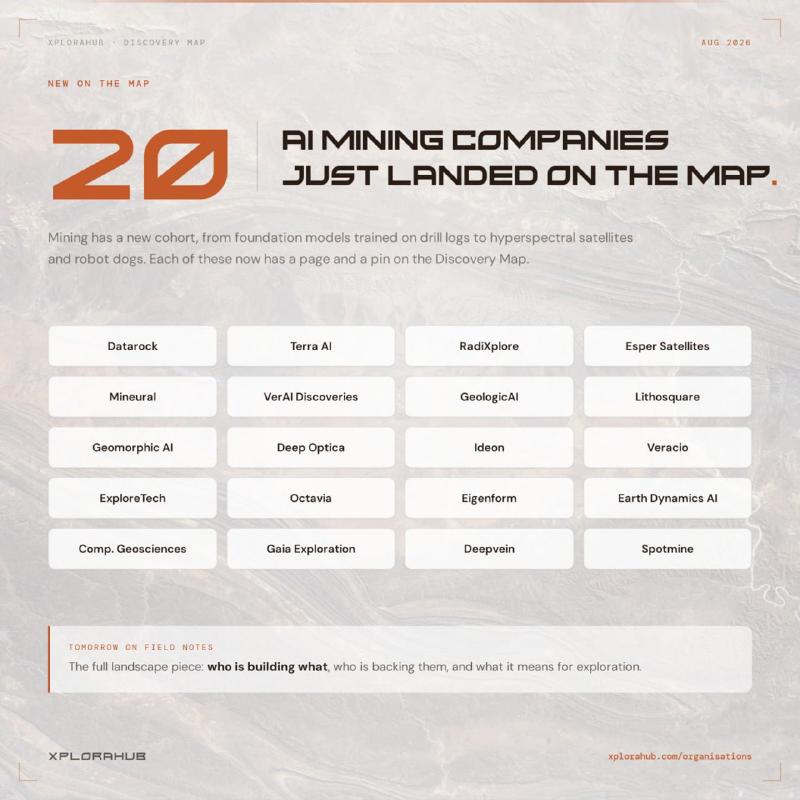
On the commercial front, this research is turning into practical, on-the-ground applications. A recent piece on AI and ML’s rise in mining at Xplorahub maps the AI and ML companies now active in the sector. Eigenform and NextMaps are among them. These platforms give geologists, explorers and resource investors spatial analytics and ground intelligence without making them work through disconnected datasets by hand. Six commercial trends stand out.
AI and Drill-Targeting Decisions
The most crowded part of the market is exploration targeting, where AI has a straightforward economic proposition: reduce uncertainty before committing hundreds of thousands of dollars to drilling.
That is also where errors are most expensive. A model that credits a licence with its neighbour’s discoveries can send a drill rig to the wrong ground. The NextMaps case study tested a pipeline on exactly that trap.
From Software to Vertically Integrated Exploration
A growing group of companies is choosing not to sell its AI at all. Instead, they use proprietary models to identify opportunities, acquire mineral rights and monetise discoveries through JVs, royalties or direct mine ownership.
Eigenform’s own AI earn-in joint venture model is one version of this. The AI earns a share of the discovery instead of a software licence fee.
AI and Proprietary Data Acquisition
Another branch of the industry pairs models with the hardware needed to generate better or faster data. That includes satellites, hyperspectral sensors, automated core scanners, muon detectors, robotic survey platforms and semi-autonomous drill rigs.
Owning the data pipeline gives these companies training data competitors cannot buy.
Mining Companies as Strategic AI Investors
Major miners such as BHP and Rio Tinto are increasingly behaving like venture investors rather than simply customers.
Rather than waiting to buy finished tools, they take stakes early in the companies building them.
Consolidation of AI Exploration Companies
Established mining-technology companies are steadily acquiring specialist AI, sensing and data businesses, with IMDEX, Epiroc, ALS, Fleet Space, Veracio and others assembling broader technology stacks.
For standalone AI startups, that makes acquisition a likely exit and platform integration a growing expectation from customers.
From AI Claims to Physical Validation
The sector is awash with claims of faster exploration, fewer drill metres and better targeting, but comparatively few have yet been independently validated through economic discoveries.
That gap will close only one way: with results in the ground. Our exploration case studies are where we publish ours.
Conclusion
The research and commercial trends describe the same movement from two sides. Research is making models more general, more multimodal and more honest about uncertainty. The market is pushing those models closer to the drill-targeting decision and asking them to prove themselves in the ground. Taken together, these macrotrends in AI for mineral exploration point to systems judged by discoveries, not by claims.
For the full technical breakdown, the preprint is the place to start, and Xplorahub’s field notes show how these tools are being deployed today.
FAQs
What are the major trends in AI for mineral exploration?
On the research side: 3D and 4D subsurface models, multimodal models that combine geology, geochemistry, geophysics and text, self-supervised learning, uncertainty-driven exploration, and foundation models with agents. On the commercial side: AI concentrated on drill targeting, vertical integration, proprietary data acquisition, miners investing in AI, consolidation, and pressure to prove results with discoveries.
How is AI being used in mineral exploration?
Mostly to decide where to explore and drill. Models combine surveys, drill assays, geological maps and historical reports to rank ground by prospectivity and reduce uncertainty before expensive drilling. Some companies use AI to pick their own ground and acquire the rights; others pair it with sensors, satellites and core scanners to generate new data.
What is AI prospectivity mapping?
AI prospectivity mapping uses machine learning to estimate how likely an area is to host a mineral deposit, based on geological, geochemical, geophysical and remote sensing data. Traditional versions produce a flat 2D map. Newer approaches model the subsurface in three dimensions, quantify their own uncertainty, and recommend where more data would help most.
What are geoscience foundation models?
Geoscience foundation models are large models trained on broad geological data. They can be adapted to many tasks, commodities and regions, instead of needing a new model for each one. Paired with tool-using agents, they could ingest new exploration data, form and revise geological hypotheses, and recommend the next survey or drillhole.
What is uncertainty-driven exploration?
Uncertainty-driven exploration uses a model’s own uncertainty to decide what to do next. Instead of stopping at a prospectivity map, the model identifies where it knows least. Methods such as active learning and Bayesian optimisation then recommend the survey, sample or drillhole that would add the most information.
What are the limitations of AI in mineral exploration?
Known deposits give models very little, and heavily biased, labelled data. Much exploration data is scattered across formats and old reports. Most importantly, few claims of faster exploration or fewer drill metres have been independently validated through economic discoveries. Results in the ground remain the real test.