Our test case was the Cue Victory goldfield in Western Australia. It has been mined for gold since the late 19th century, so there is a wealth of publicly available data. In 2021 significant rare earth deposits were also found there. That combination let us build a clean test: take only the data from before the rare earth discovery, and see whether the models could point to where those deposits would turn out to be.
To stop the models using hindsight from their training data, we replaced well-known place names and mining companies with pseudonyms and swapped tenement IDs for placeholders. “Cue Victory” became “Coe Fairbairn.”
Stage 1: Data preparation
First we used our own suite of proprietary map-processing tools to convert scanned PDFs into machine-readable map files and tables, chunking and indexing everything. This is not simply digitising images. The system has to deal with broken lines, faded shading and multilingual legends, and turn them into polygons where every edge and vertex actually connects.
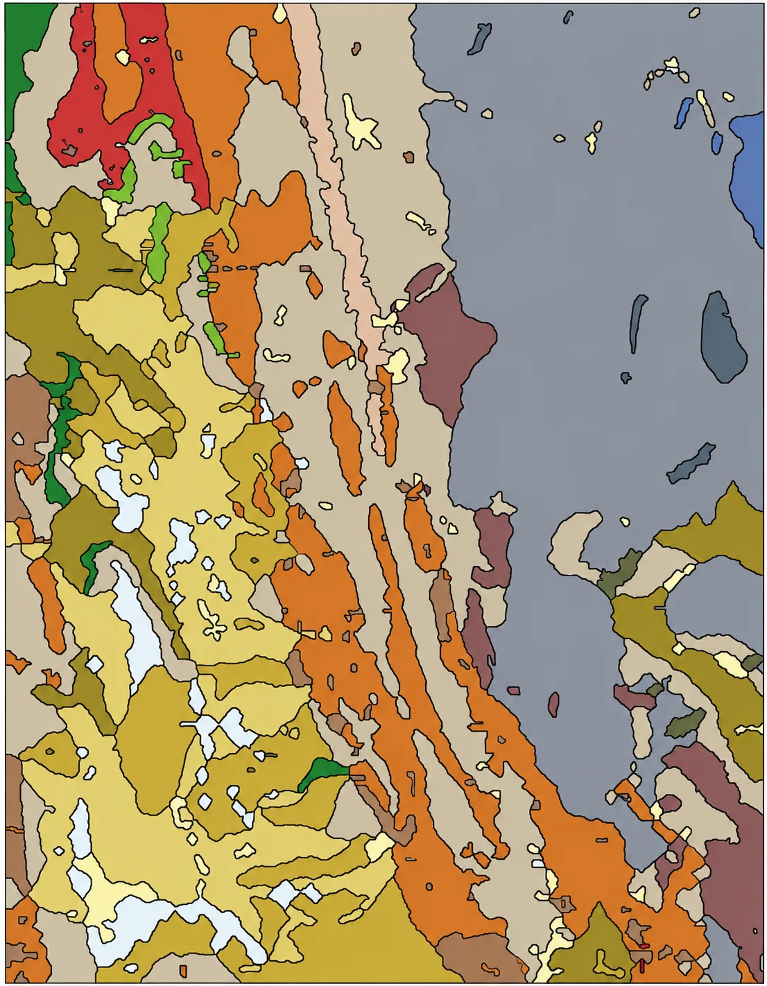
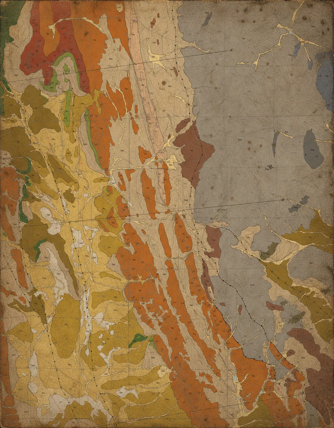
Stage 2: Inductive world modelling
The model then searched the data, writing code to identify and confirm relationships between features. Most geological AIs stop here. Ours goes further, using a mineral-systems and information-geometry approach to build the most informative single model it can. If all the features in a region emerged from the same geological processes, then learning more about one feature carries some information — however small — about the others, which is what turns scattered datapoints into a coherent mineral-systems thesis.
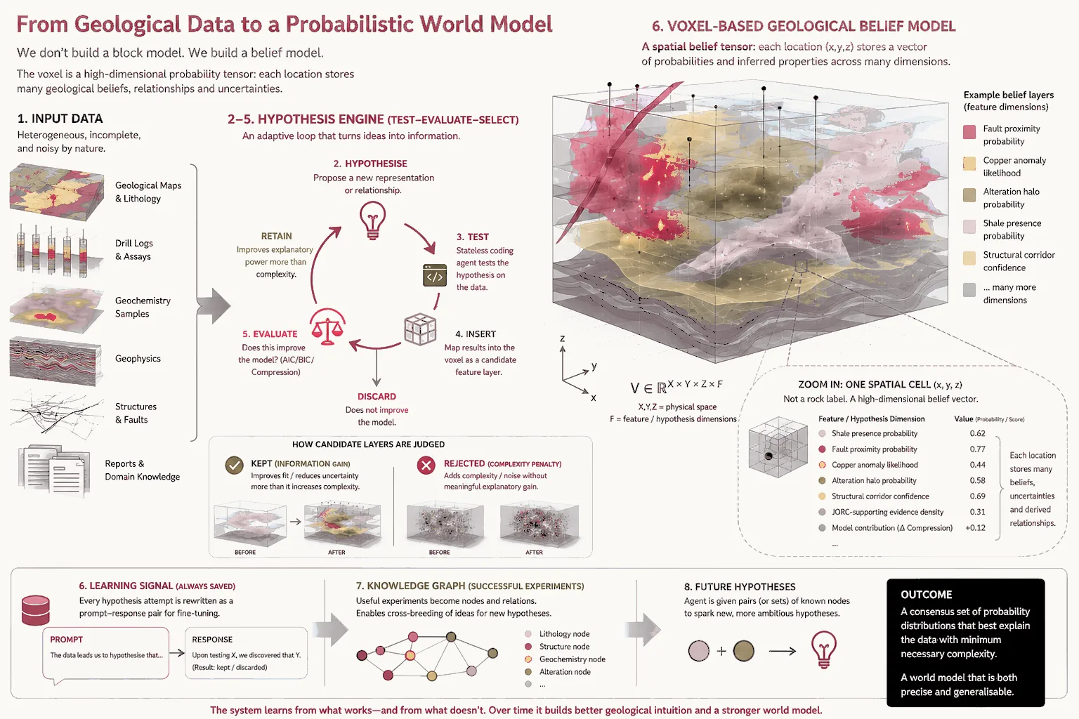
Stage 3: Where to dig
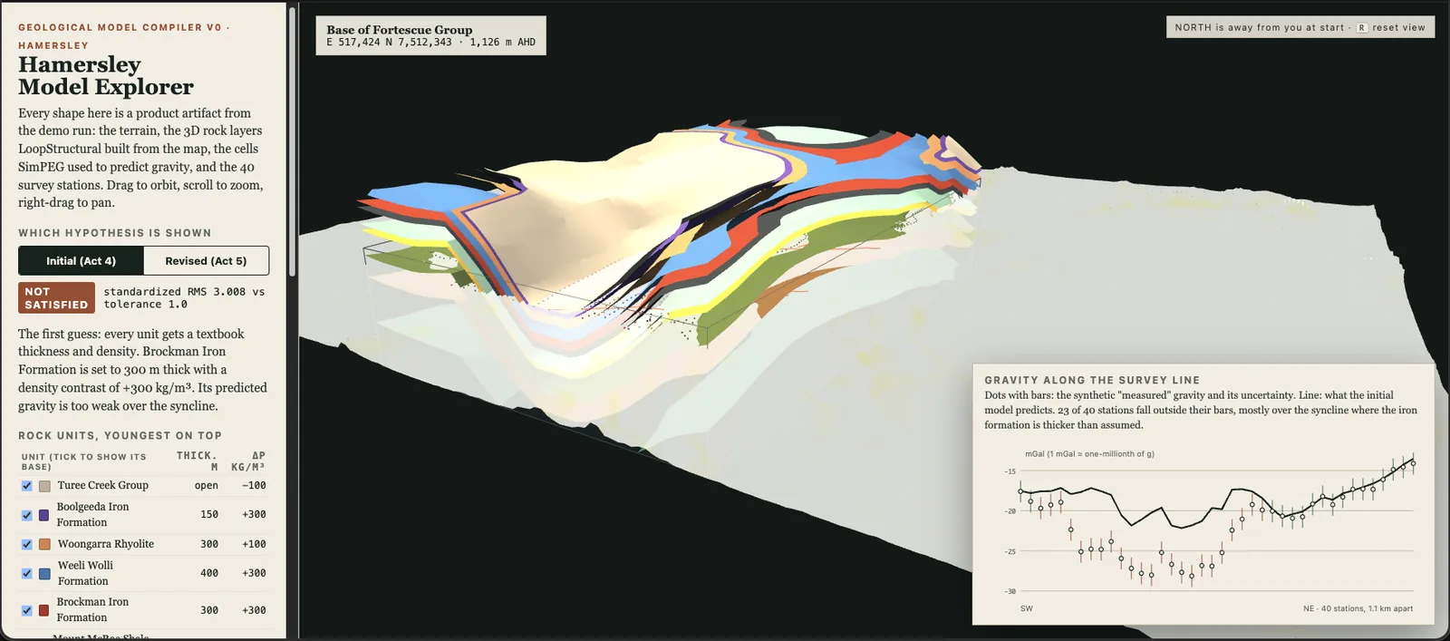
The inductive approach to data taken by the models allowed them to compose probability layers — mineral pathfinders, interesting fault lines, even neighbouring mines’ behaviour — into prospectivity heat maps and physics-aligned coherent structural subsurface projections.
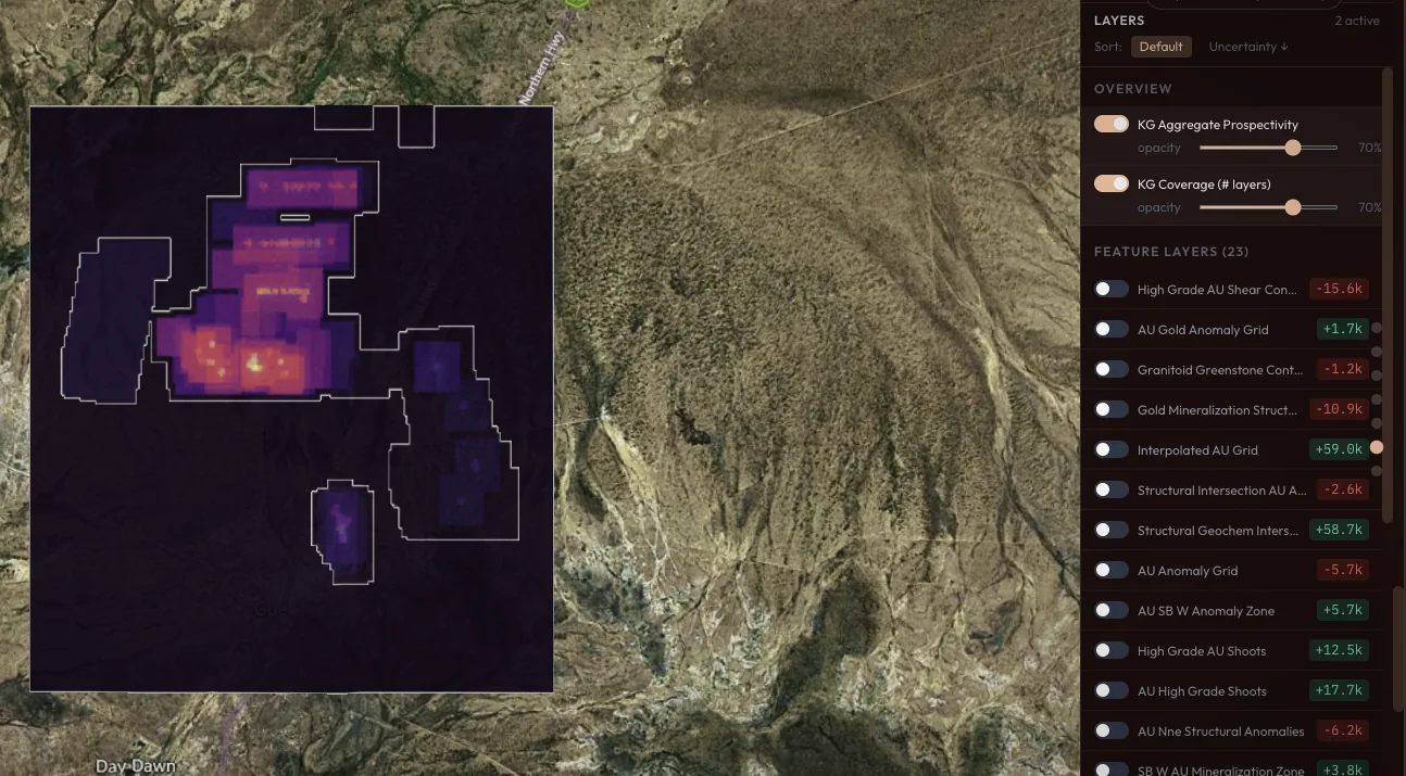
Stage 4: Learning to discover more
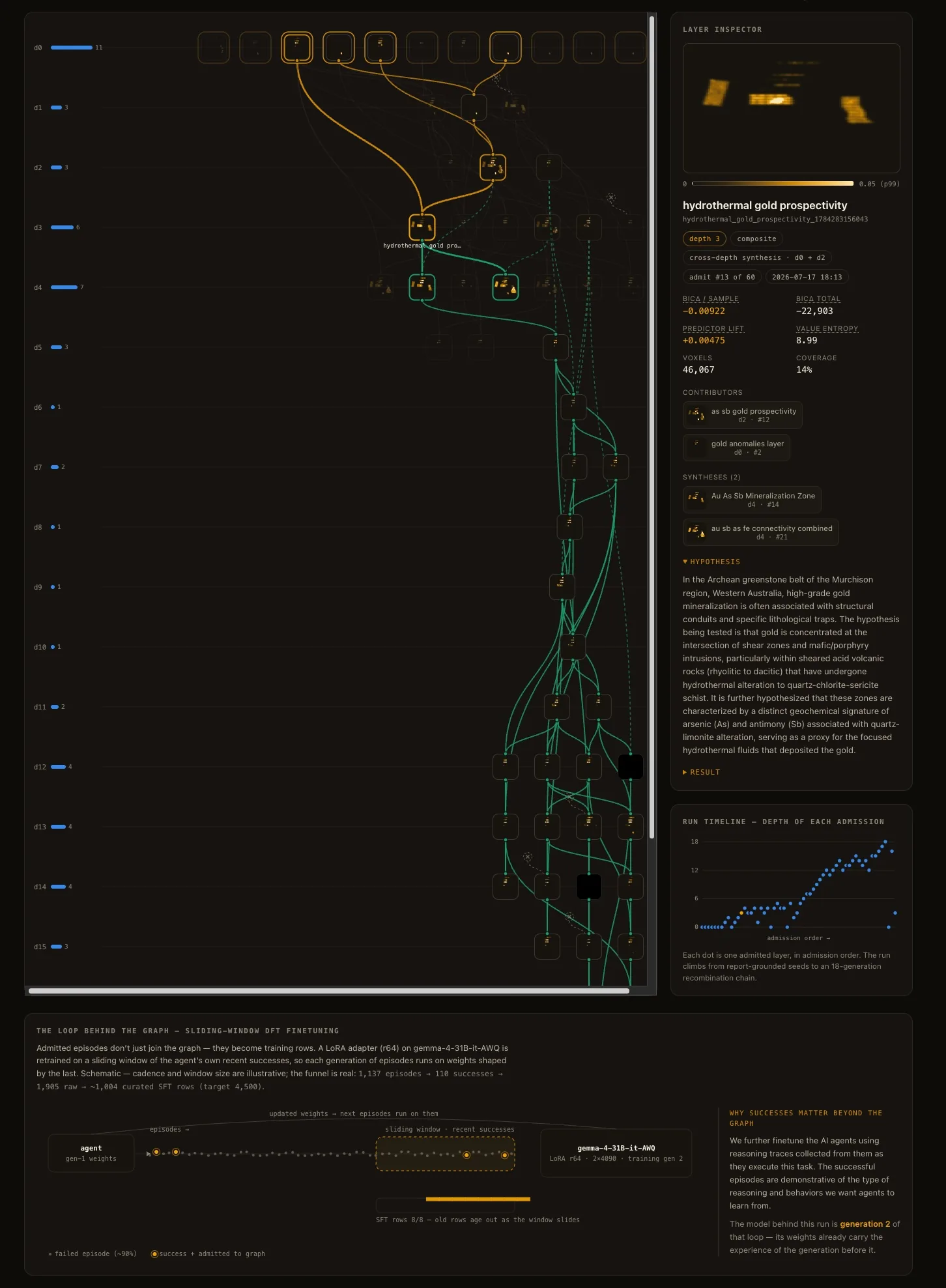
The reasoning traces from successful experiments can be turned into focused training examples for the agent. The model is rewarded for reaching a correct final answer, but it is also taught the intermediate skills of geological feature engineering. In early rounds we have seen a 15–17% improvement on our internal geological baselines.
Result: a new old discovery at Cue
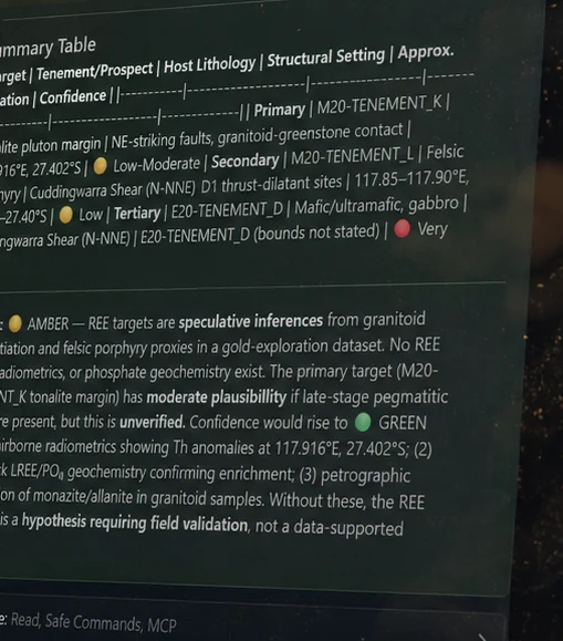
Given only gold-exploration data from before the 2021 rare earth discovery, the models still pinpointed where in the region rare earths would eventually be found. The system reported it honestly — as a testable hypothesis that would need field validation, not a settled conclusion — which is exactly the register we want.
Work with us
What might be lurking unnoticed on your ground?
If you hold exploration data that has never been worked through properly, we would like to hear about it. Our technical contribution can form part of an earn-in or joint venture rather than a conventional software engagement.